Monday, June 30, 2008

Buena Vista to Denver

Friday morning we started from the campground outside of Buena Vista on Hwy 285 with 2 climbs and 50 miles for the day. We had a nice ride through the valley up to Trout Creek Pass. Then we descended into South Park and headed toward Fairplay. The traffic increased and a horrible rumble strip appeared. Then the headwind started. We struggled and had completed around 25 miles and then stopped. Conditions were really getting scary. We were in deep discussion about contacting Ray and Brenda, when we heard a car pull up behind us. We turned around and there were Ray and Brenda! We had a brief discussion about wind, traffic and the road and agreed that a ride to Denver was the best decision. There was a challenge putting the bikes and the trailer and all of us in the car, but we succeeded.
The ride to Denver was an excellent idea as we watched the shoulder disappear and the traffic increase. We spent the night at Bear Creek Park and headed to Belinda's mom's house Saturday morning. We're visiting relatives in Denver and Longmont through July 5. We start back on the road Sunday the 6th from Ordway, Colorado on Hwy 96.

Thursday, June 26, 2008

Over The Continental Divide

Today we left Sargents and immediately began climbing towards the Continental Divide at the top of Monarch Pass. The picture above is looking back towards the West. We were climbing without our gear or Jack as our friends Ray and Brenda kindly took all the baggage (and Jack) in their car for us (they will continue this act of mercy untill we reach Denver). We made good time going up as the grade was a fairly uniform 6%. We reached the top of Monarch Pass in about two hours.


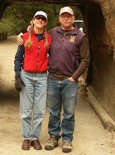
It was sunny and cool at the top were we met up with Ray and Brenda. Brenda took this picture of us in front of the marker. To us this was an important moment. Crossing the Divide felt like the point of no return, there's nothing for it now but to keep on to the East Coast. After all, it's all down hill from here, right? Yeah, right. Well as we descended the views to the East were beautiful.


We descended the eighteen miles to Poncha Springs rapidily. At Poncha Springs we found a little resturant named Thai Mini Cafe where we had a great lunch. We were certainly surprised to find great Thai food in a tiny burg like Poncha Springs! From Poncha Springs we turned north on Hwy. 285 which will take us all the way to Denver. Tonight we are staying in a KOA just outside Buena Vista. We will be at Belinda's Mom's house by Saturday.

Wednesday, June 25, 2008

Blue Mesa to Sargents

Yesterday we left Blue Mesa and gently wound our way up Hwy 50 next to Tomichi Creek, where we spotted this buck. The day's ride was much more enjoyable than the previous day as we climbed only 1000 ft. in 51 miles to Sargents, and we had a fantastic tail wind the whole way! To top off the day, as we approached Tomichi Creek Trading Post in Sargents we were greeted by two of our closest friends, Ray and Brenda. We had a most joyous reunion!

We are taking a rest day in Sargents, at the foot of the serious climbing to the summit of Monarch Pass and the Coninental Divide. Ray and Brenda are going to take our gear and Jack in their car allowing us to climb unburdened, what joy! They will continue to sag our gear the next several days into Denver. On a sad note, we believe we have lost the companionship of our young friend John. Yesterday he decided to continue over the pass to camp on the other side. We have no cell phone service here so we have lost contact for now. Time presses for John so we think he will push on to Pueblo and beyond. He has been our companion since Fallon, Nevada and he will be missed. John is a creative, intelligent young man with a sunny disposition. John, good luck and best wishes, keep in touch through the blogosphere, and perhaps we can get together again on the East Coast.

Montrose to Blue Mesa Reservoir

The ride out of Montrose began innocently enough. The morning was clear and the uphill grade gentle. As we were leaving town we began to be passed by a parade of faster cyclists on unloaded bikes. We had unwittingly joined the Bike Tour of Colorado. After a while the tour turned off Highway 50 and we were once again alone. Soon we were climbing more steeply up the first of two passes for the day's ride. As the day wore on the thunder head clouds began to build. The picture above was taken from Blue Mesa Pass. By the time we reached this summit we had climbed 3500 ft. and were quite tired. We were taking a break at the top for rest and a snack but our rest was soon interupted by the crash of thunder and rain. We got on our bikes and got off the pass pronto! Somehow our fatigue had suddenly disappeared! In the next hour or so we were soaked and then dried. After a long tiring day in the saddle we made to Blue Mesa Reservoir and made camp at Red Creek, where these pictures were made.


Sunday, June 22, 2008

Rico to Montrose

Saturday, we bid farewell to T.J. with much advice about the climbs and descents we faced. The climb up from Rico to Lizard Head Pass on Highway 145 was spectacular. The mountains seemed to multiply around us and it was hard to keep our attention focussed on the road. Near the top of the pass we were struck by the sight of El Diente (the Tooth) off to the left. On the right the whole of the San Juan Range stood before us, towering and covered in snow.
During our descent, Dave stopped to talk to some fellow tourists and was passed by T.J. and his brother who had ridden over the Pass before us and were on their way back to Rico. A final farewell and thanks was given. The descent from Lizard Head took us through alpine valleys filled with avalanche chutes, into red rock cliffs carved by the San Miguel River and finally to the junction of Highway 62 at Placerville. Our final climb over the Dallas Divide took us past North Pole Peak in the Mt. Sneffels Wilderness. As we crested the Divide, the Continental Divide stretched out in front of us, then we descended for 11 glorious miles into Ridgway. Saturday ended with a total of 2900 ft. of climbing and 67 miles. We camped at Dutch Creek Campground on US 550. An easy 20 miles brought us to Montrose today, where we rejoin US 50 to continue eastward.

Dolores to Rico

Friday was our first day of beauty in the mountains of Colorado. We headed northeast up highway 145 climbing up the San Juan Valley adjacent to the Dolores river. We passed grassy meadows surrounded by aspen and tall pines. The climb was gradual and we felt relaxed and enjoyed the cool mountain breezes. The mountains got taller and the river ran faster as we approached the town of Rico.

Our original goal was to get to a campground 6 miles past Rico. But when we pulled into Rico, we were tired after 1900 ft. of climbing at 5:00. We decided to eat and explore our camping options in town. We pulled up to the BBQ House where 3 small children were collecting bugs and riding bikes in an adjacent lot (ah small town life). A gentlman on a bike pulled up and started asking us questions about the trip. We gave him the usual responses and then asked him about camping in town. He said we probably could camp anywhere since there wasn't a town cop and then offered his lawn and hot showers at his house. His daughter worked in the restaurant and he said he would be back when we were done eating. We decided to take him up on his offer and subsequently learned he had bicycled across the states 3 times, around Australia several times, and from Portugal to England via Czechslovakia. We had a great time sharing cycling stories and he could just not stop throwing the ball for Jack. Thank you, T.J. in Rico, from Dave, Belinda and John.

Thursday, June 19, 2008

Blanding, UT. to Dolores, CO.

Just after we left Blanding on Wednesday via Hwy 191 we rode past Recapture Reservoir and the reflection could not be ignored. The day was fairly easy with rolling country except for about ten miles of newly laid chipseal which gummed up our tires and reflected all the heat of the day on us. The country gradually became more agricultural in nature with winter wheat and alfalfa greening the landscape. The highlight of the day was the Colorado border where we took this picture just before crossing the street and having a couple o' beers at the Stateline Tavern.

We knew this was an exceptional establishment when we noticed the front door stop was an prosthetic leg with a boot on. The biker proprietor regaled us with stories of the natural wonders of the area infused with a healthy dose of politics as well. In Dove Creek there was no obvious place for us to stay, so we checked in at the Sheriff's office, and they allowed us to pitch our tents in the one city park that had bath rooms. Today, Thursday, we rode out of Dove Creek on Hwy 491 through more rolling agricultural land. The region is known as the Pinto Bean Capital of the World. In Lewis we turned on Hwy. 184 and gently ascended past Narraguinnep Reservoir. After a 500 ft. climb we descended into Dolores where we are staying tonight. With the exception of yet another flat tire early in the day, the day was easy and uneventful. In Dolores the first order of business was to get to the bike shop and obtain new tires with better puncture resistance and new inner tubes (our old ones being much patched).

Tuesday, June 17, 2008

Hanksville to Blanding


In Hanksville our best information was that we we were facing three days, two nights without reliable water sources so on Saturday before we left we loaded up with lots of heavy water, an additional 36 lbs in the trailer alone. The weather was hot and we were consuming a lot of water on our way down Hwy. 95 towards Hite at the eastern end of Lake Powell. In route we stopped at Hog Spring where water was running so we filtered enough to replace what we had already drunk. Finally we made a great descent to Lake Powell and Hite through a gap in the red rock blasted out for the road. It was a long day and we weren't sure what we would find at Hite. We had been told that due to the drought, Hite was closed and there was no water. What we found was quite different. People were using the boat ramp, the bathrooms were open, there was water, and even the store was open (though we arrived after it closed and left before it opened).
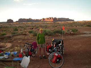

Sunday, Father's Day, we faced a 45 mile gradual climb of 3000 ft. to Natural Bridges National Monument. The first part we paralleled White Canyon, which looks like a great place to explore, full of slots and verdant vegetation in the more open stretches. Not all of the climb was gradual, there were some steep pitches, and again the weather was hot. We weren't sure that we would make it all the way to the Monument, climbing the whole way heavily ladened. But in the end we set our caps for the Monument and rolled in late in the afternoon. John broke two spokes on the climb and spent a good portion of the day making road side repairs. The campground at the Monument was dry but there was good cool water at the visitors center, so we never really had a dry camp after all, though with the weather so hot we consumed a lot and didn't feel bad about carrying so much.


The trip from Natural Bridges to Blanding on Monday was a net elevation loss, it was a very challenging day none the less. Early in the ride we had a fast prolonged descent on which we all set new personal best speed records for the trip. Belinda broke 42 mph, Dave 47 mph, and the speed demon John hit 48 mph. Then the road turned ugly. We crossed several washes, with a fast descent to the bottom followed by very steep climbs out. In one five mile stretch, Belinda was pulling the cart, there were four pitches so steep she was having trouble even pushing the cart up the hill. So Dave would ride to the top of a pitch, park his bike, and jog back down to help Belinda push her bike and cart to the top. It was also a day of flat tires. We had five flats between the three of us, Dave had one, Belinda and John had two flats each. At last we reached Blanding. As we have been seven straight days on the road we are taking a rest day here on Tuesday. We are doing laundry, patching inner tubes, and cleaning up the bikes. Tomorrow we will ride out of Utah on Hwy 191 to Dove Creek, Colorado!

Torrey to Hanksville

Friday, the 13th (nothing bad happened!) we left Torrey and rode into Capital Reef. In Capital Reef National Park we passed through great red rock formations and the very pleasant Fruita District, an early Mormon settlement famous for its orchards along the Fremont River. The early settlers found ancient artifacts of the Fremont people including irrigation ditches thousands of years old. We took a short walk to view pictographs left by the Fremont people. It is humbling to think of these ancient people making their living in this harsh environment.


We next passed through a very sere region of sparse vegetation and a predominantly grey color. Our friend John asked "What planet are we on now?". Indeed, we later learned that the locale was known as Luna Mesa. In the middle of this moonscape is Cainville. Don't blink or you'll miss it even on bikes. We pulled over for lunch at a very inviting patch of shady grass in front of the Cainville Cove Inn. We were just setting up to eat when Nancy, a blond mom of several youngsters and an abundance of energy and enthusiasm, came out to greet us and gave us two bunches of cold grapes to enjoy with our lunch (very welcome as the weather was quite warm). Nancy also made restrooms available to us, and later when we went to thank her for the hospitality she made us eat watermelon and gave each of us a pile of cookies to take with us. Again, the kindness of people like Nancy renew our faith in humanity.

Friday, June 13, 2008

Escalante to Torrey

Wednesday dawned with high clouds and cool temperatures, perfect for the climb to Boulder. After we left Escalante we had to descend to cross the Escalante River approx. 10 miles downriver from where we hiked. The picture above shows the road winding and winding down into the river gorge. To see the detail, click the picture and it will become full size. The climb out of the gorge was amazing with 14 % grades and beautiful views of Calf Creek Canyon.


We camped outside of Boulder and Thursday morning headed up the mountain for a climb of 3000 ft. in 12 miles. Along the way, we kept seeing these old cars that were obviously part of a rally. One of the cars a Landrover sedan honked and waved at us on its way down. A little bit later the same car drove past us going up the mountain. When we got to the summit the driver had jumped out and was taking pictures of us. We stopped and talked with David and Lorraine from Hong Kong who are driving their 1960 Landrover from Panama to Alaska (14,000 miles). They were intrigued with our adventure and with Jack. We wished each other good luck after taking pictures. We headed down the pass and got to Torrey late in the afternoon. Today we ride east on Hwy 24 to Hanksville. Our ability to post may be limited from Hanksville to Blanding.

Tuesday, June 10, 2008

Rest day in Escalante

Today (Tuesday) we are taking a rest day in Escalante. We are staying at Escalante Outfitters, another do it all establishment. They are a motel, campground, liquor store, coffee shop, internet cafe, pizza place, book store, and a hiking/camping store. Belinda and Dave are staying in one of these little log cabins (which seem to be in all the private RV/campgrounds). It's nice to be in a bed again. John has pitched his tent again as he must watch his pennies.

This morning we went for a hike down the Escalante River canyon. Two years ago we paddled up the Escalante arm of Lake Powell with Bill. So now we've seen the river from the other end. We haven't been disappointed yet.

Panguitch to Escalante

Well, we have been traveling through real Wiley Coyote & Road Runner country! Its is fantastic and beautiful scenery. Sunday's ride to Tropic on Hwy 12 took us through Red Canyon. There is every manner of contorted rock formation you can imagine. As a bonus, there was a seven mile bike path through the canyon. This not only let us ride traffic free, but it meant that Jack could get out of the trailer for a little run. He seemed to really enjoy this.


On Monday we passed Powell's Point on the way to Escalante. We couldn't help reflecting on this man's great accomplishments. A one armed explorer, surveyor, and mapper he charted the whole Green River and Colorado River drainages. This is some of the most rugged country in the US.

Saturday, June 7, 2008

Milford to Panguitch


I'll bet not many of you have heard of Panguitch, Utah, huh? Well, this is the first internet connection we've had for a few days. When we woke up in Milford Thursday morning there was snow on all the mountains around. The forecast was for scattered thunder showers, but with clearing in the afternoon, and thats just the way it went. We climbed over the hill to Cedar City and in so doing, left the Great Basin. Now the country around looks more like one would expect Utah to look, red rock cliffs and table top mesas. Cedar City is a bustling town of 20 thousand people, the biggest town we've seen for a while. We stayed in the KOA there, and could have had internet but we lost the access code and the office was closed by the time we discovered the loss. At breakfast we shared coffee with a fellow rider ,Ed, who we met in Baker. He was staying in Cedar City for a prolonged rest as the next leg was the hardest climb of the trip so far. We faced 4500 ft. of climbing up Cedar Canyon in 21 miles.
Indeed this climb made Carson Pass seem like a cake walk. In twelve miles we had climbed 3000 ft. and were done in. We stayed the night in a nice little wooded campground just off the highway. The one consolation was that the scenery was stunningly beautiful. The next day we finished the climb at 10,500 ft. elevation in Cedar Breaks National Monument. Here the environment was alpine and the air quite cool. Then we turned downhill for a 30 mile roller coaster ride into Panguitch. We are camped in a small RV park with a little patch of lawn in back for tents. The next two days will be fairly easy rides, finishing in Escalante, where we will take a rest day.

Wednesday, June 4, 2008

Baker to Milford

Tuesday morning we packed up to roll out of Baker on our own. Bill, Pete and Susan wished good luck before we left and they packed for their return to Sacramento. We slowly peddled out of town with heavy loads. We were going to split the next 85 miles into two days and dry camp at the top of Wah Wah Summit. We soon hit the Utah border and took pictures.


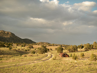
Many friends have enquired about Jack and here is a picture of him riding in his chariot (the dog cart) as we ride towards Mormon Gap.

We had two long climbs and the valleys in Utah seem so much bigger than in Nevada. There is also an interesting wind pattern to each valley. Descending from the pass we have a headwind, across the flat we have a crosswind, and ascending the pass on the other side we have a tailwind. After 52 miles we found our campground at the top of the pass. Here is a view up the dirt road from the highway. We listened to the weather radio and knew the good weather was changing again. This morning clouds filled the sky, we packed up and headed into the headwind on the descent from Wah Wah. At the bottom of the Wah Wah valley we were hit by tremendous side winds reducing our speed on the flats to 5-7 mph. Rain clouds, thunder and lightning could be seen on the San Francisco mountains ahead. We persisted and finally reached the point with a tailwind and made the 1400 ft. climb to Frisco Summit. The storm had passed over us with some light hail on the climb; however a very cold tailwind pushed us to Milford. After we warmed up, we checked the weather radio and realized that we had just ridden through a major wind advisory for southern Utah and Nevada.

Rest Day in Baker

After two long days totalling over 140 miles, we needed a rest day and some time to explore Great Basin National Park. Bill, Pete, Susan and John decided to go hiking/snowshoeing to the Bristlecone Pines. Dave and Belinda decided to see the world famous Lehman Caves. They were dropped at the Caves with their bikes to ride back to the motel since the hikers might be out longer. The caves were amazing with many unusual features. There were huge columns, shields, and draperies. One room was called the bacon room because light shined through the draperies had the appearance of slices of bacon. The caves were used for many things before the park service took over; parties, weddings, boy scout campouts, and a movie set.
At the day's end, we all got back together and shared adventures over another great meal at the Lectrolux Cafe. We had commandeered the main table for several meals now and were on a first name basis with the owner.

Ely to Baker

Well, this was the first day riding without Bill. He decided to go in the car with Pete, Susan and Jack to explore The Great Basin National Park. We will miss him and his own special brand of humor. We were able to ride unencumbered again as we would all be reunited in Baker, NV. We rode against a stiff headwind until we began the ascent of Conners Pass when the wind turned to help us over the top. At the bottom of the descent we stopped at Majors Junction where we had a beer and saw a Basque condo (sheepherder's wagon). We then turned north through Spring Valley with a great roaring tailwind. We turned southeast to climb Sacramento Pass, our last climb in Nevada. At the top of the pass, Wheeler Peak came into view.


We had a quick descent towards Baker with a tailwind until Dave got a flat tire. Soom we peddled into town and the Whispering Elms Motel where Jack quickly made friends with the parents of the owner. We were only 6 miles from Utah!